The project aims to address the increasing amounts of water we are going to experience where we live and investigate what it will entail for coastal communities -The project is a constructive aqueous proposal for the “settlements on the edge” which will allow residents not only to remain living in close proximity to the ocean, but at the same time heighten residents awareness of, and attunement with water in both everyday and crisis situations alike.

Denmark is a low laying country with a long coastal line. Lots of cities and clusters of houses are faced with the issues following sea level rise combined with the increased frequency of cloud bursts. Communities by the sea are furthermore troubled by, not only sea water, but water from inland too. Fortification put in place to secure settlements from the seaside, must allow access for water pass through.
To sum up the problem: we are dealing with water from above, and decreasing capacity for groundwater below, and sea water from the sides. To handle the dilemmas, strategies like flight, fight and adaptation are being used all over Denmark.


The hereby individual strategies largely depend on the respective municipality and their economy. Larger cities can receive municipal or state funding for their coastal proofing- or adaptation projects, whereas smaller communities often must pay themselves for such protection. Smaller communities that cannot afford to pay to fight off the rising waters, often resorts to another strategy: that of flight. Fleeing from the ocean and moving inland.
Adaptation and fortification can be seen as a 'crock' and a 'welly boot'. One allows protection but no contact with water, and the other one allows small measure of protection, while also allowing contact with water. - Climate mediation lies somewhere between the two, providing contact and protection alike, which is where the project is looking for socio spatial qualities.

The project is situated in a coastal settlement southeast of Copenhagen, which is in one of the critical flooding zones. This map show a small community of ~1700 households individually fenced off with hedges.


Possibilities of development strategies were explored through the notion of "demonstration project" – testing out a network of rainwater/stormwater channels inside the frame the community, connecting to the already existing network outside the community, with empahsis on the notion of creating possibilities instead of boundaries. The channles will work as a way of collecting water, and transporting it to the nearest pumping stations, proposed to be placed at the dikes.
The pumping stations will house additional programs to create a spatial gateway between community and sea, offering a transition zone, and a connecting attunement moment with the water for the community, and serve as a reference for similar communities in Denmark.


The following phases in the development strategy, takes its beginning with the creation of channels on the side of every road. The channels are then connected with the "outside" network which will provide circulation for water, and allow it to distribute evenly. Larger reservoirs are installed where its possible. All channels are lastly connected with pumping stations along the reinforced dike.
Instead og using underground piping for water handling, the strategy introduces technical water infrastructure at surface level via a symbiotic approach with nature, providing value and space.


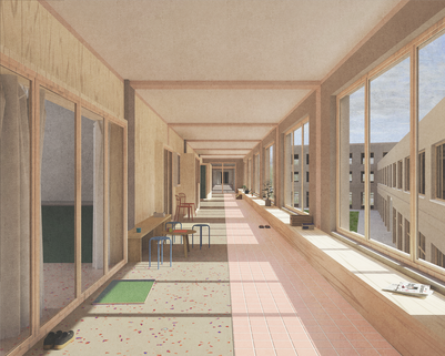
Station A, contains an auditorium for the housing-association and school etc. Station B, contains bathing and sauna facilities near the existing 270 m bathing bridge. Station C, contains space for storage of boats and kayaks, as well as the bathing bridge in the winter.

Each pumping station is provided with a open maintenance / control room in addition to the individual program at the station


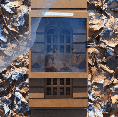
Model photos:


Selected pictures and observations from Søvang, Dragør.


Quick sketches showing movement with water, throughout the program - from the inland fields to sea.